

Click HERE, HERE, and HERE for an update concerning the severe weather threat Thursday night and into Friday morning.
Changes from the previous update:
- The threat of severe weather has decreased for much of the area
- The timing has slowed down a little more
Overview:
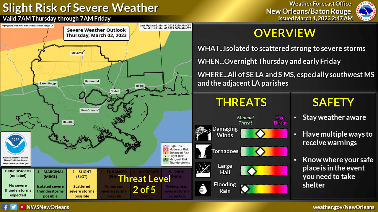
WHAT: MARGINAL RISK and SLIGHT RISK of Severe Weather
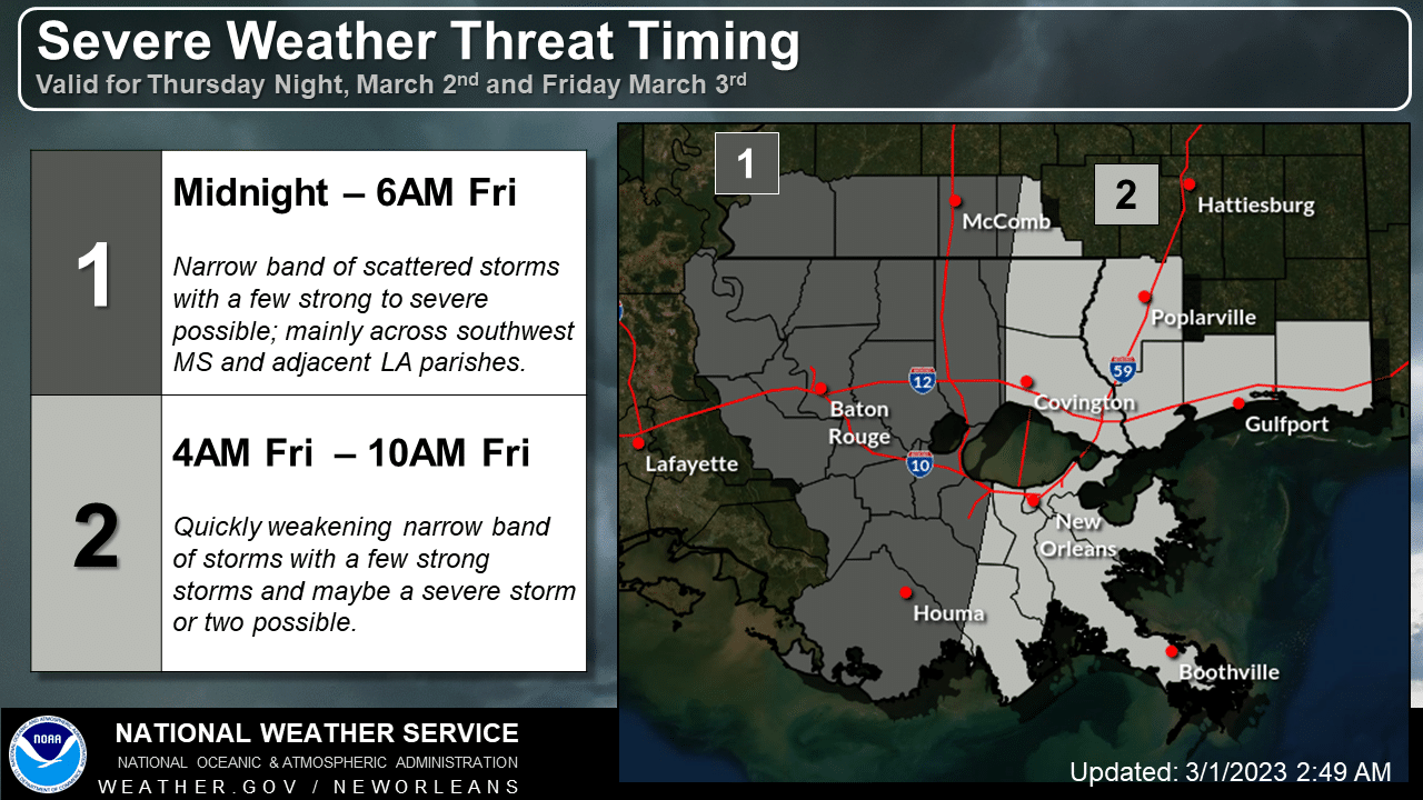
WHEN: Thursday night and Friday morning
WHERE: All of southeast LA and southern MS but the greatest threat is across southwest MS and the adjacent LA parishes
CONFIDENCE:
- We are still confident there will be a narrow band of thunderstorms moving across the northern half of the outlook area; north of the 10/12 corridor. South of the 10/12 corridor, rain may even be hard to get. We have low confidence that anything more than a few storms will be strong to severe.
- We also have low confidence in timing thus the large time range.
Impacts:
The main threats associated with any severe storms will be:
- Damaging Winds: Wind gusts greater than 60 mph will be possible
- Tornadoes: A few tornadoes will be possible
Even though the threat of severe weather is on the low end for our area, if it does occur it will be an overnight event likely after midnight and before most people start to wake up. You can receive warnings overnight through Tangi Alert, WEA and NOAA Weather Radio.


