

Click HERE and HERE for an update concerning the severe weather threat on Thursday.
Overview:
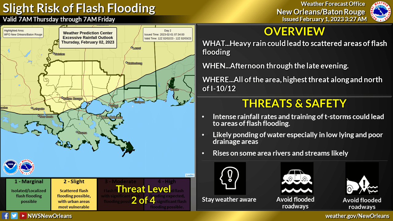
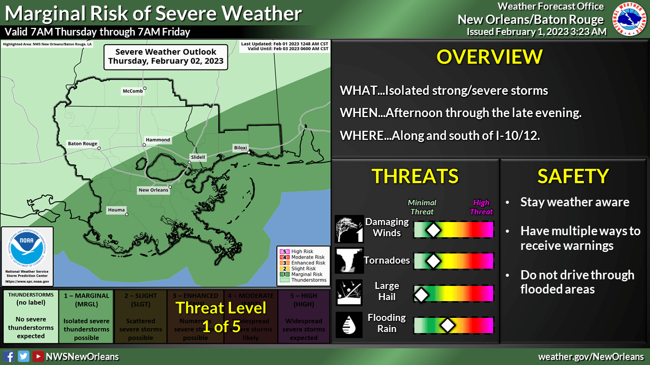
WHAT: MARGINAL RISK of Severe Weather and SLIGHT RISK of Heavy Rainfall.
WHEN: Mainly the afternoon into the late evening hours
WHERE: All of the area is in a highlighted risk area, but areas north of I-10/12 have the greater risk of heavy rainfall while areas south of I-10/12 have the better chance at seeing severe weather.
CONFIDENCE: Moderate confidence that we will see showers and thunderstorms on Thursday, lower confidence in details of any potential severe weather and heavy rain.
Impacts:
- The main threats associated with any severe storms will be:
- Damaging Winds: Wind gusts greater than 60 mph will be possible
- Tornadoes: Isolated tornadoes can’t be ruled out
- Rainfall: In addition to the severe weather threat, high rainfall rates could lead to ponding of water in low lying areas and areas of poor drainage.
Additional rises on some river areas will be possible.


